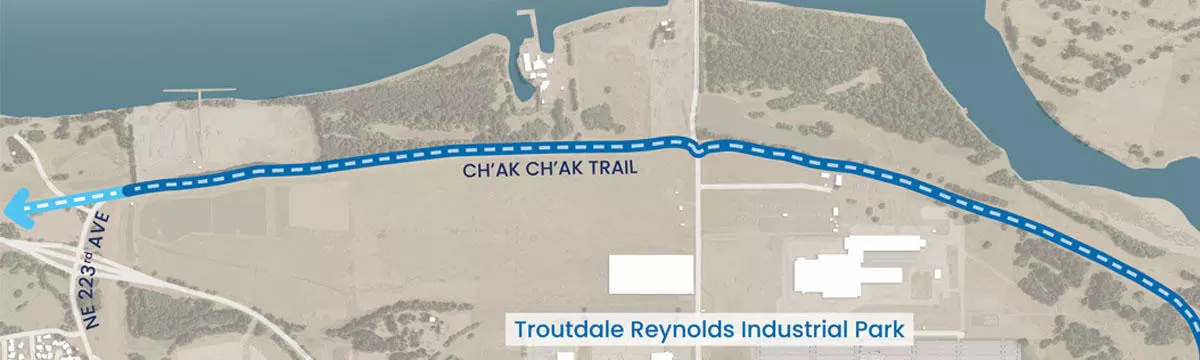
The Ch’ak Ch’ak Trail is a scenic 3-mile segment of the historic 40-Mile Loop maintained an operated by the City of Troutdale. Starting at Depot Parl near downtown Troutdale, the trail runs through Troutdale’s northern industrial area where it connects to another segment of the Loop, which runs along the levee between NW Sundial Road and NW Graham Road, near the eastern end of the Troutdale airport runway. In turn, that section of the Loop continues atop the levee onward to Chinook Landing Marine Park in Fairview.
History of the 40-Mile Loop
Originally proposed by the renowned landscape architecture firm Olmsted Brothers in 1904, the 40-Mile Loop was designed to create a 40-mile trail encircling Portland. Over the years, the vision has expanded, and once finished, the Loop will stretch approximately 140 miles, connecting more than 30 parks throughout the Portland Metropolitan area. This continuous loop will follow the Columbia, Sandy, and Willamette Rivers, creating a greenway that ties together parks and natural areas.
Naming the Ch’ak Ch’ak Trail
A few years ago, when the City of Troutdale was planning this segment of the trail, Metro planners asked for a name. This led the Parks Advisory Committee (PAC) to take on the task of finding a meaningful and culturally significant name.
Initially, the Committee suggested “Wabun,” a Native American word they found online. However, it was later discovered that “Wabun” is from the Ojibwe people of the Canadian Great Plains and not connected to the native peoples of the Troutdale area.
Upon learning this, the Committee sought a name that better reflected the local Indigenous culture. They consulted with Greg Archuleta, a Chinuk Wawa language and history expert and member of the Confederated Tribes of Grand Ronde. With his guidance, the Committee chose the Chinuk Wawa word for Bald Eagle: Ch’ak Ch’ak, a name rooted in the local heritage.
New Connections
The Ch’ak Ch’ak Trail officially opened on October 10, 2024, with a celebration at the NE Harlow trailhead. The trail connects the 40-Mile Loop trail system, the existing trail along the I-84 bridge, and Troutdale’s Sharon Nesbit Heritage Park. As it passes through the park, the trail offers scenic views and improved access to the Sandy River Delta natural area, as well as future trail connections into the Columbia River Gorge. The trail and park will also support planned private commercial and residential development at the Confluence site.
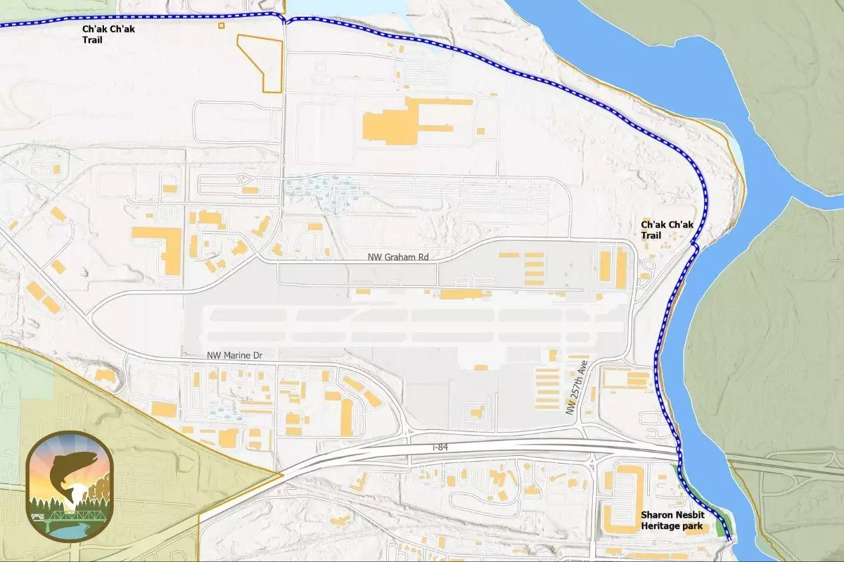
Map of the Ch'ak Ch'ak Trail and connection to Sharon Nesbit Heritage Park
Directions
1100 NE Harlow Road
Troutdale, OR 97060